There is a reason why people say to budget at least 10 days for the Ring Road, but unfortunately, we only had a week to work with, and didn’t want to NOT do the Ring Road, so…it just meant very little sleep and a lot of go-go-go action. Not the most relaxing vacation, but we sure covered a lot!
Our day started early with some breakfast from a well-known bakery nearby, Bakari Sandholt, where we loaded up on delicious pastries for the road. Our first stop was the famed Golden Circle, a little detour en route to the Ring Road, which follows the national highway route 1 around the circumference of the island. The Golden Circle, by contrast, is an extremely popular tourist attraction as it hits on some of the “best of” attractions of Iceland within close distance of Reykjavik, so we encountered tons of tour groups and buses. But, I’d say it’s still a can’t-miss. We only had time to hit up 2 of the 3 attractions – Thingvellir and Geysir – and ran out of time to visit the immense waterfall Gullfoss. Not all waterfalls are created equal, but we figured we would see quite a few other impressive falls later on our trip and we had to prioritize.
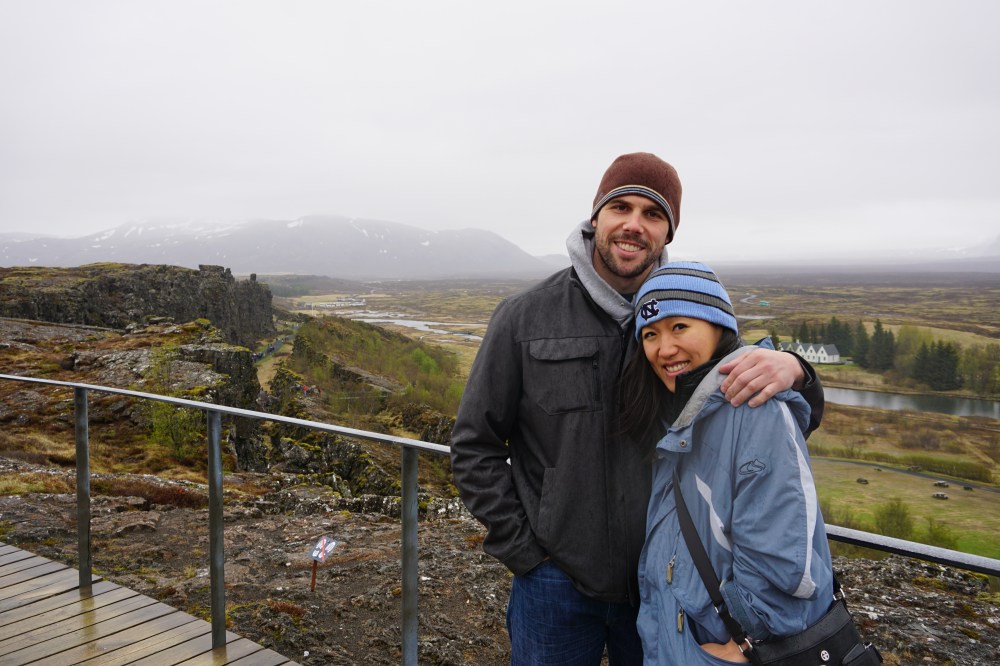
Thingvellir is a historic site as it is not only where the two continental plates meet, but also where Iceland’s first parliament met in 930. For those who have the luxury of time, and the interest, it’s a great spot to snorkel in clear (chilly) waters and tell people you’ve snorkeled between two continents! We only had time to walk around the area to take in the geography and views before heading off to the next stop.


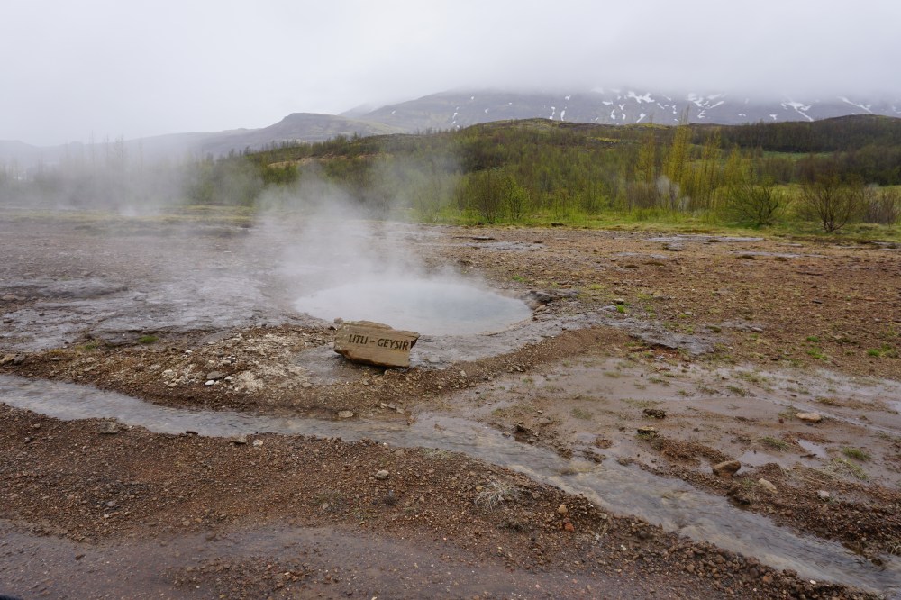
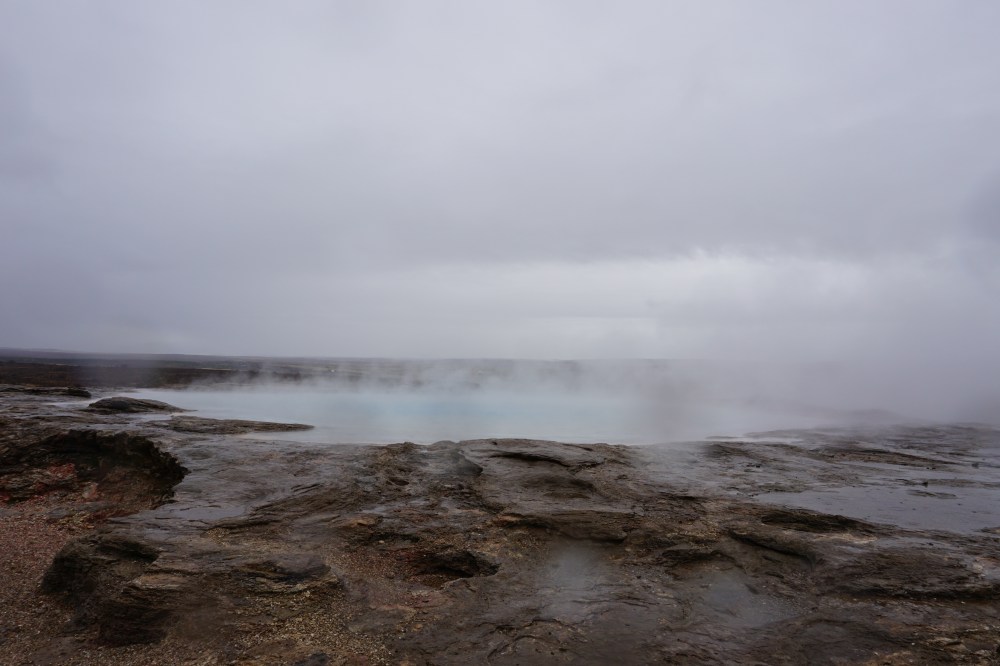
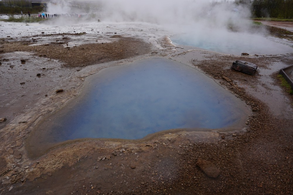
A quick 30 minute drive later and we were at Geysir, the namesake behind those shoots of hot water and steam that erupt out of the ground after building up so much pressure. The actual geyser named Geysir actually hardly ever erupts anymore, but its neighboring Strokkur erupts every few minutes, treating us tourists with some pretty sensational shows. The landscape nearby was pretty gnarly, with extremely thin crusts of earth interspersed with steam vents and boiling pots of water gurgling around.

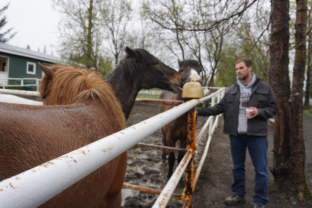
We had to rush a bit this morning because we had made reservations at Fridheimer Tomato Farm, a destination high on my list and known for its all-you-can-eat tomato soup buffet. Set within a sustainable greenhouse located on a working horse farm, the restaurant was situated among tomato vines, powered by solar-heated water and pollinated by bumblebees imported from the Netherlands (as I don’t think Iceland naturally has any bees). The menu was centered around all things tomato but the real option people come for is the tomato soup buffet, complemented with a fresh bread bar. I think we each had at least 3 bowls of soup and won’t even divulge how many pieces of bread…it was soooo good and perfect for a rainy, chilly day!


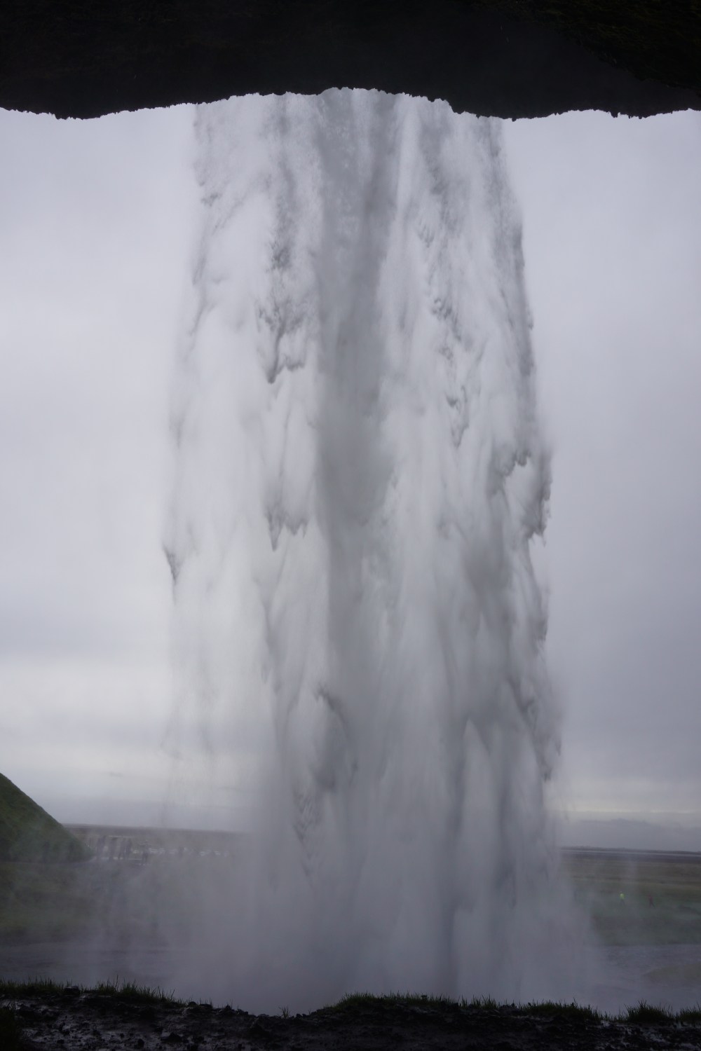
We then officially started our journey heading counterclockwise on the Ring Road, a 2-lane highway flanked by the occasional house or farm, and more frequently, sheep or waterfalls. Also, a word to the wise…nothing is as close as it seems on the map, so definitely budget for a little extra time to get to/from each stop. Our first stop was the iconic waterfall Seljalandsfoss, which like many of the landmarks, we could spot right from the highway. There are over 10,000 waterfalls in this tiny nation, yet each had their own unique identity. Seljalandsfoss was neither the biggest nor widest, but was unique in that you could actually walk right behind the falls. We explored along the path around the waterfall, passing several smaller waterfalls, and actually stumbled across the lesser-known “secret” waterfall, Gljufrabui. This was a much smaller waterfall hidden behind narrow canyon walls, and could only be accessed close up by walking to it from the wading pool. Some adventurous visitors could be found with pants rolled up wading barefoot, but we were already chilled to the bone standing in the cold misty rain, so we just admired it from afar.


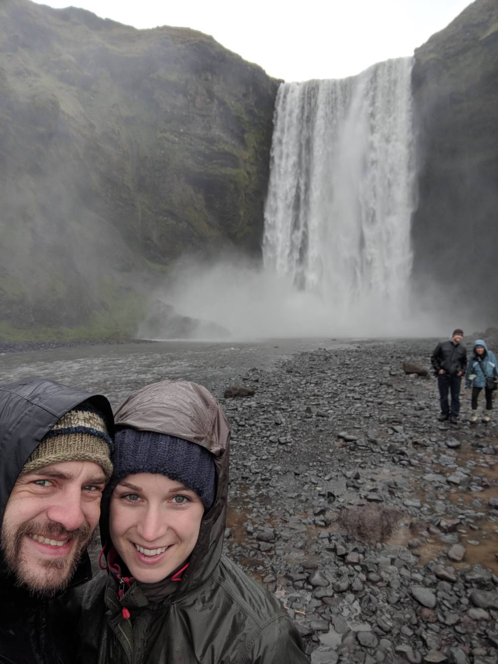
Continuing our drive, it was a mere 25 minutes later that we stopped at neighboring waterfall Skogafoss. A much wider, more powerful waterfall, we had to walk up roughly 400 steps to reach the viewing platform directly above the falls. We could also walk as close as we dared to the bottom of the falls, where we got absolutely soaked (or maybe it was just the rain also coming down?!). Oh, and there were sheep EVERYWHERE – did you know there are 7 sheep to each one person in Iceland?


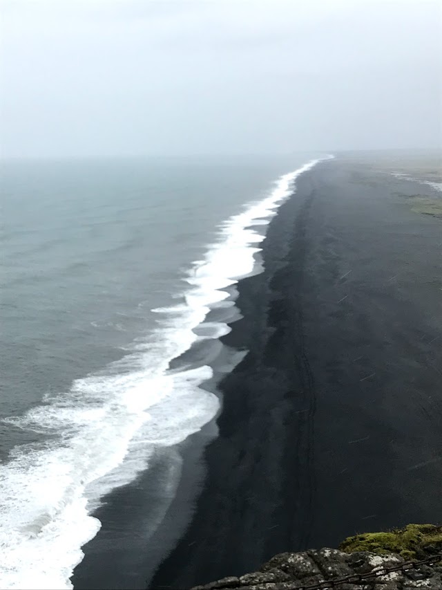
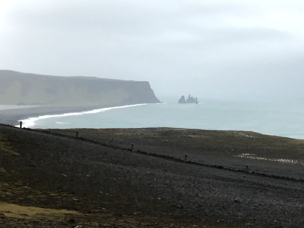
Our last landmark for the day, during our super aggressive itinerary, was Dyrholaey, a craggy peninsula known for its rock arch by the same name, home to a popular puffin breeding ground. By this point, it was dinnertime and the weather had taken a nasty turn – not only was the cold rain starting to chill us to the bone, but the winds along the peninsula were absolutely brutal. So we literally jumped out of the car, took a few pics before our cameras got soaked, and ran the course of the gravelly path to get a quick look at the area before jumping right back in the car.
By now, all we wanted was to pull over, peel off the multiple layers of rain-soaked clothing, and change into something warm and dry. And fill our stomachs. So we drove to the closest town, the quaint village of Vik, population ~290. In general, there just aren’t that many restaurants outside of the 2-3 major cities, so we had to strategically plan around the restaurants we were aware of, or settle for picking up hot dogs from gas stations. We found Suder Vik, one of the few restaurants in town, which didn’t seem to be a well kept secret at all as most of the town and south coast tourists were already here too. They were so busy they actually didn’t have any tables ready, so we waited it out in the beer hall downstairs while we warmed up and dried off and then enjoyed a hearty Icelandic meal of local char with roasted sunflower seeds, almonds, grape/lime sauce, and potatoes. Tonight’s Airbnb required a bit of backtracking along the Ring Road to the village of Hella, where we stayed in a modern cottage on an adorable farm for the night.